
Reality capture software for 3D documentation
Capture and integrate reality directly into your design process with ReCap™ reality capture software. ReCap point cloud and image-based 3D modeling software and services work seamlessly with Autodesk design and creation suites, so you can start your design with accurate dimensions and full photo-quality context rather than a blank screen.
Features for ReCap Pro
Point cloud software for 3D laser scanning
Demos show how ReCap™ Pro point cloud software helps improve your reality capture workflow for 3D laser scanning. Cut project time by more than 50% without compromising data accuracy. Easily process point clouds in the field with targetless registration and open scanner support.
Hardware-independent 3D laser scanning
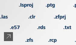
Support for all text-based and 3D laser scan data.
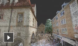
Photorealistic data visualization
Photorealistic 3D or panoramic visualizations.
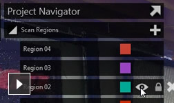
Point cloud editing and cleaning
Clean and organize point clouds with simple tools.
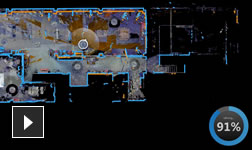
Laser scan data alignment
Create as-built models with laser scan alignment.
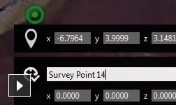
Survey point addition to point clouds
Add survey points to point cloud models.
Detailed 3D design in context
Use as-built conditions in detailed 3D design.
Precise and accurate building renovation
Accurate as-built conditions for renovation design.
Construction verification
Verify as-built conditions for construction.
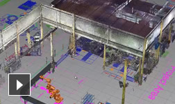
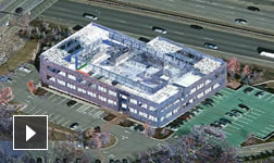
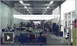
Existing factory layout
Visualize as-built conditions for facility layout.
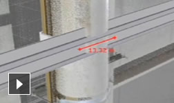
Equipment removal or installation
Use point clouds to detect equipment clashes.
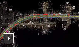
Road visualization and design
Use point clouds for road visualization and design.
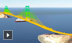
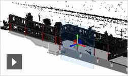
Bridge visualization and verification
Compare actual bridge construction with the design.

