Speed the civil infrastructure design process
Engineer large-scale preliminary designs in context with InfraWorks 360™ and collaborate with multiple stakeholders virtually anytime and anywhere. Extend your design capabilities with the ability to access specialized industry tools. Take advantage of foundational sketching and modeling capabilities with InfraWorks™ in a Suite, create 3D models, and generate design concepts.
Features
Infrastructure modeling and visualization
View demos and videos of InfraWorks™ features. Transform preliminary design workflows so civil engineers and planners can deliver projects more efficiently, by managing larger-scale infrastructure models created from existing data sources, engineering in context from the start, and generating proposals at the appropriate level of detail.
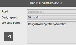
Civil engineering and roadway design software
View videos and demos that show how to quickly and easily create civil infrastructure design models with InfraWorks™ civil engineering design software. Roadway design tools help accelerate the roadway design process, and enhance understanding of project constraints for better decisions.
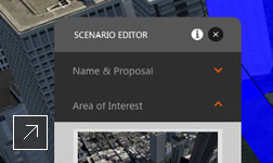
More intuitive user experience NEW
INFRAWORKS IN A SUITE, INFRAWORKS 360
Experience a persona-based interface.
Experience a persona-based interface.
INFRAWORKS 360
Perform advanced design, simulation, and analysis.
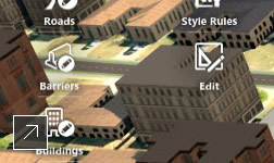
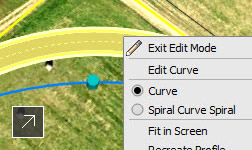
Layout capabilities
INFRAWORKS IN A SUITE, INFRAWORKS 360
Add roads, bridges, and buildings to your model.
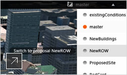
Evaluation of multiple proposals
INFRAWORKS IN A SUITE, INFRAWORKS 360
Better predict performance of design alternatives.
Edit and share models with InfraWorks 360
View demos and videos of InfraWorks™ 360 features for publishing, storing, and managing large models centrally and more securely in the cloud. Invite team members to access, download, and edit shared models simultaneously and review multiple project proposals using the same data. Access models regardless of location, format, or transmission.
Managing and publishing models
INFRAWORKS 360
Publish centrally and more securely in the cloud.
Field access
INFRAWORKS 360
Access models via web and mobile devices.
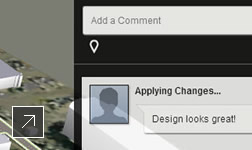
Quantitative, real-time feedback
INFRAWORKS 360
Accelerate approvals with the Design Feed feature.
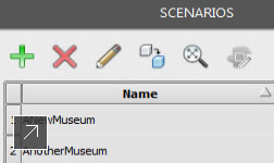
Scenario publishing (enhanced)
INFRAWORKS 360
Engage stakeholders via web/mobile access.
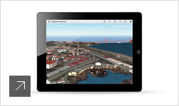
InfraWorks iPad app
INFRAWORKS 360
View models and scenarios on your iPad.
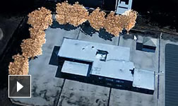
Compelling infrastructure visualizations
View infrastructure project videos that highlight InfraWorks™ visualization capabilities. Create captivating, ultra-realistic visualizations, and present design alternatives more accurately in context of the existing environment. More accurate infrastructure project visualizations support stakeholder engagement and add perspective to engineering teams in detailed design.

Ultra-realistic visual effects
INFRAWORKS IN A SUITE, INFRAWORKS 360
Add dynamic sun and shadows, water, and clouds.
Real-time scenarios
INFRAWORKS 360
View scenarios in real time interactive sessions.
Improve planning with data-rich infrastructure models
View civil planning demo videos that show how to use InfraWorks™ software to more efficiently build large infrastructure models from existing 2D CAD, 3D model, GIS, and raster data. Generate more accurate preliminary design proposals, in context, at the appropriate level of detail. Better predict how alternatives may perform within the built environment.
Automate model creation NEW
INFRAWORKS IN A SUITE, INFRAWORKS 360
Build models from data-rich global content sources.
Model the existing environment
INFRAWORKS IN A SUITE, INFRAWORKS 360
Use visuals to inform decision making and buy-in.
Use data and models from Autodesk products
INFRAWORKS IN A SUITE, INFRAWORKS 360
Import data from Revit, Civil 3D, Map 3D, and more.
Import data and combine models (enhanced)
INFRAWORKS IN A SUITE, INFRAWORKS 360
Create base models from GIS, Raster, DGN, Sketch Up.
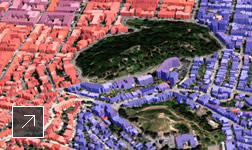
More reliable results with geospatial analysis
View model analysis demo and videos showing InfraWorks™ model analysis tools that support better understanding of a project’s geographic context. With InfraWorks, geospatial analysis, such as buffering, overlay, and slope analysis, is integrated into the planning and design environment to help support better decision making throughout the project.
Dynamic site analysis
INFRAWORKS IN A SUITE, INFRAWORKS 360
Work with different data types from many sources.

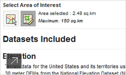
Measure distances and areas
INFRAWORKS IN A SUITE, INFRAWORKS 360
Determine best location for design elements.

Shadow and lighting analysis
INFRAWORKS IN A SUITE, INFRAWORKS 360
Predict how shadows may affect project designs.
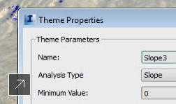
Theme palettes
INFRAWORKS IN A SUITE, INFRAWORKS 360
Visually classify assets according to attributes.
Related Products
Industries